A Path for Many Ways

The South West Coast path is mostly so narrow you can neither overtake nor pass anyone, without some polite interaction. Mostly the conversation goes like this:

Me: ‘Good morning’

Other: ‘It is indeed. Beautiful. Enjoy it’.

But I have grown bold having walked more than a month, over 400 kilometres right across the top of the Exmoor National Park, and the Counties of Devon and Cornwall. For the record, in this time, we have experienced one misty morning and 5 minutes of drizzle, both in June.

So I add: ‘It is glorious here every day!’ This usually elicits invitations (which sound more like threats) to come back in winter, when the path is a slew of mud and dung, and the ocean is gulping down chunks off the rock face.

Every few days we do indeed find that bits of the path have fallen away, where walkers are diverted further up the hill, into paddocks. 2014 recorded the largest Atlantic storms in 60 years along parts of this coast.

The South West Coast footpath is an important part of tourism infrastructure, providing access to the beaches, coves and historic sites of interest. In Cornwall alone, it generates £300 million a year and supports 7500 jobs (PhD thesis by Claire Siobhan Earlie, Plymouth University). A retired engineer-turned-B&B-host tells us over breakfast that the rate of erosion has been much the same for 10,000 years. Still, Cornwall was one of the first counties in the UK to declare ‘climate emergency’, whatever that means.

For now though, the weather is perfect one day and just a tad warm the next. And thousands of summer revellers are using the path to get to their favourite sunny July activity.

Old and new tourist destinations are dotted along the South West Coast Path. In towns like Penzance, the railway line in the 1800s laid the foundations for summer tourism, with visitors flocking to the beaches nearby, some sandy, mostly rocky, but invitingly warm compared to other parts of Britain. The many rugged parts of the coast have inspired generations of artists, novelists and film-makers. From Rebecca <https://en.wikipedia.org/wiki/Rebecca_(novel)> to Poldark <https://en.wikipedia.org/wiki/Poldark> the Atlantic coast from Hartland Quay to Falmouth has repeatedly starred as the brooding, darkly angsty extension to moody heroes and sultry heroines. Indeed, the morning at the end of June, as we left the Hartland Quay Inn, the last coastal hotel in North Devon, the film crew for the latest version of Rebecca were rolling in.

TV’s Doc Martin has boosted the recognition of Port Isaac. Rick Stein outlets and other eateries have put Padstow on the world’s gourmet map. St Ives even has a Tate Galley to bring in the ‘Culcha-wallahs’ from around the world. Then there are towns like Hayle, which lost everything when the mining boom in Cornwall ended in the 19th century and now depend on the cheap end of tourist and retirees market for their survival.

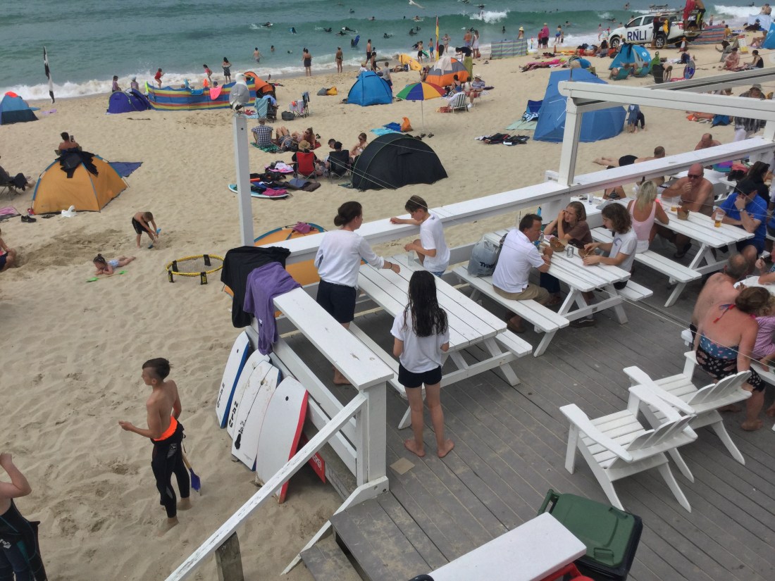
Near such towns and the many other attractions strewn along the path, you can find yourself in a traffic jam, with dogs off leashes, kids in thongs, beer-guts and couples insisting on hand-holding where you can barely walk in a single-file. For most, the path is merely a means to take the shortest route to a destination where cars cannot reach. So the crowds melt away quickly, leaving most of the 1000 kms thinly populated with ramblers, hikers and trail runners.

Runners pass by like the wind. Ramblers are a hard to define. But it’s a very British thing (see https://www.ramblers.org.uk/) and for some reason most ramblers we have met along the way are white men of a ‘certain age’. Some of the ramblers might also be long-distance walkers, but more likely they have gone over the same ground time and again, so that they know their own parambulating patch like their own back yard. Ramblers stop to chat, encourage and inform. They know every turn in the path and every cove where you might see a seal, or where a boat went down ‘just a few years ago’ (in 1981, for instance, between Mousehole and Penzance).

Long distance walkers are even fewer and further between. We have met, perhaps a dozen who are walking one or two weeks at a time and planning to complete the path in a few years or decades. And have met just 6 or 7 who are trying to complete the path end to end – in one go.

Between Tintagel and Port Isaac, we run into several groups of teenagers hiking and camping for three days as part of their ‘Duke of Edinburgh Award’ <https://en.wikipedia.org/wiki/The_Duke_of_Edinburgh%27s_Award>. One of them has a special assignment to interview hikers who are going the ‘whole way’ and I am the first one she has spotted!

My young interrogator wants to know why I am walking and what are the ‘key challenges’. The second one is easy: having the discipline to do a hard day’s walk and to get up the next day and do it again and again and again. Unlike tourists, hikers have no sense of destination. Unlike the runners we don’t keep time. Unlike ramblers, we don’t develop that abiding bond and knowledge of the place. Unlike dog-walkers, we are not doing it in the best interest of another being. Why did I set out on a long walk? I’m trying to figure that one out as I go, I tell her.

‘Mal’ (not his real name) is the only English ‘end-to-ender’ we have met. The other half-dozen have all been young Germans. We met Mal about a week into our walk. His rucksack weighs at least 4 times mine. He is carrying a tent, which he pitches wherever he can find a flat bit of land. With enough beer at the last pub on the day’s walk, he can fall asleep anywhere. I can hear him fifty paces away when he is labouring up a hill behind me. I admire Mal, but cannot imagine being without the creature comforts of a bed and a shower at the end of the day. I even have my bag carried when a section of the walk seems too long or too hard.

The South West Coast Path has to please a large and diverse clientele. And thanks to an army of volunteers from the National Trust, the South West Coast Path Association and a myriad of other agencies, it remains user-friendly, for the very few Mal-s at one end of the user-spectrum and at the other, the throngs armed with Trip Advisor’s top-ten lists, out to take selfies at the ‘second scariest cliff’ or the ‘largest Cornish Pasty’ in the world. And, then there’s all of us in between.

Two hundred years ago, this path was part of a crowded, morbid, polluted, industrial corridor, ravaged by centuries of mining for tin and copper and quarrying for granite and other hard stones. Some scars from mining still remain. But with a little help from humans, most of the pits are growing over and blending back into magical wild gardens.

As you walk the path, right on the edge of an ocean that’s rising ever faster, as you scour for the next signpost advising you of another rockfall, another diversion, you have to wonder what will remain of this much-trodden footpath in another 200 years?

Camino Addict’s Notes from UK’s South West Coast Path

Dateline: Morwenstow

From the Camino addict’s point of view, there is more to Morwenstow than meets the eye, which is a very good thing, because not much meets the eye: a pretty ordinary looking old church, a farm cafe, an old pub and half-dozen assorted small dwellings. (Those unaware of this ailment called Camino Addiction, please go to <https://readingontheroad54893552.wordpress.com/2018/08/14/first-post/> on this site or google Camino, and you will find dozens of sites where walkers are talking incessantly about trails which start from various points in Europe and end in the Cathedral of Santiago in North Western Spain.) Of course, for the addict, the Camino is never far away. The foreshore in Minehead, the little tourist town where the South West Coast Path officially begins, is way-marked with shells. ‘Just decoration’ the young lass at the tourist office says, ‘No connection to the Camino’. But two weeks into the walk the Camino appears again, immanent and emphatic, an old love who won’t be forgotten, even though you are in this exciting new venture with this much younger road.

The official website for the South West Coast Path grades the section across the border of North Devon into Cornwall as ‘severe’, which is the highest in their four point scale of difficulty. Most through-hikers will take about 10 hours from Hartland Quay, the last hotel on the coast of North Devon to Bude, the first tourist town in Cornwall. We, very fortunately, have managed to book one of just 4 rooms available in Morwenstow, above the old pub called Bush Inn. So just 13 kilometres of treacherous roads rather than the 25 to Bude.

We had reached the Atlantic coast the day before, when at Hartland Point in Devon, marked only by a car park and a shack selling packaged soup, the Bristol Channel officially folds seamlessly into the ocean. From afar the Atlantic is still as a pond, rolling calmly off the edge of the earth. Closer up, sections of the stony shore have been slashed to shreds with vicious claws. Elsewhere, cliffs are chiseled into abstract angular sculptures which change shape with every turn in the path and this path wriggles like a snake, constantly, Boulders rise from the deep like temples.

The Atlantic is not the only architect of this scenery. These coasts have been stripped for slate and quartz for centuries. A variety of technologies for cutting and hauling stone have shaped much of the shoreline over which the current walking track is laid. With the quarries gone, the ocean has fully reclaimed its coast, which is eroding now, the papers say, at an alarming rate.

Our very own first hand experience of ‘alarming erosion’ comes an hour or so before Morwenstow. For various reason we are unusually late starting out. Our Hartland Quay hotel manager says ‘this is the most difficult day’s walking of the entire path’. We are more than usually apprehensive because we haven’t yet discovered that for the next 100 miles, every bar-tender insists that the next 10 are the hardest miles of the route. None of them appear to have walked much beyond the ten-mile radius of their pub. They do however know the near-by coast like the back of their own hands and can scare the daylights out of most outsiders (which is everyone who has not lived in that particular village for at least 30 years) with vivid descriptions of the rugged rocks and stormy seas.

The walk on this day is indeed gruelling. After about four hours of long climbs and sharp descents we enter the hallowed land of Cornwall, with due genuflection to WB’s (Walking Buddy) ancestors who left this lofty land for the sandy beaches in a flat land down under a hundred years ago. A few minutes after passing what might have been (not sure because one high rock feels much like another when you have been climbing all day) the second highest coastal cliff in Cornwall, about 230 metres above sea level, we arrived at what was definitely the end of the road, literally in the brambles, with no path ahead of us and where the right foot had to be placed precariously a foot below the left just to keep standing. A slightly bent wire fence separated us from the grazing cows on the hillside to our left! I’m not quite sure what was on the right; I wasn’t going to look. WB does not like crossing legal lines such as fencing. But this was no time to be finicky. We scrambled over the wires, fortunately not electrified or barbed, up the hill without a second thought and for once I was happy to be walking amongst cattle!

At the stiles, which we knew separated one paddock from another or paddocks from the path, we saw the small, mostly washed out piece of typed notice about the recent landfall, which has forced a re-direction of the route – yes, through this paddock! I guess we had missed the notice earlier on the path, at some point before it had fallen into the ocean, or the notice had been blown away.

Soon after this exciting diversion a church spire came into view. On the Camino almost inevitably the pilgrim sees the medieval church long before arriving in a village. But on the SWCP the distant view of an old church makes Morwenstow unique. Our hearts quickened with anticipation of our night’s stop as we arrived in front of a pretty ordinary looking two-storey building with a huge sign ‘Bush Inn: 13th century Freehouse’. My Camino Amigos will have guessed by now that this building had once given shelter to pilgrims on their way to Santiago.

‘The Bush Inn has a long history of hospitality dating back to 950 AD’, said the information sheet in our room. ‘It is believed at that time to have been the monk’s rest for those on the pilgrimage route from Wales to Spain who crossed Cornwall between the North Devon ports and Fowey.’ The South West Coast Path will later pass through Fowey, but alas, there are no more pilgrim boats from there to Northern Spain. Morwenstow to Fowey is about 420 kilometres. The Camino is coming with us, sort of, on this new journey we are on.

Post-script: It turns out that Bush Inn was expecting us on 30 June. When we didn’t arrive and they could not get us on the mobile number they had from our booking.com reservation, they called the only hotel in Hartland Quay, guessing correctly that, like most long distance walkers on this route, we would have stopped there on the day before getting to Morwenstow. Hartland Quay confirmed we were indeed there and the hosts at Bush Inn, simply moved our reservation to the next day, 1 July, with absolutely no penalty! As WB was profusely apologising to the wonderful surveyor-turned hotelier about putting him to so much trouble , the lady of the house explained to me quietly that they had been really worried about us: ‘Some walkers fall down you see and ‘ave to be fetched by helicopters. Mostly in winter of course. But cattle go over all the time. And dogs too…’

Yes, the walk into Cornwall takes your breath away in all sorts of ways. As our Morwenstow landlord put it: ‘the cliffs get MMOCCHH bigger as soon as yer’ cross into Cornwall from England’. We had crossed the second tallest Atlantic cliff in all of Britain today, he says, and tomorrow, we will cross the tallest.