Back on Track: Wisques to Bruay

In response to my last post, a wise reader suggested that one ought not to compare lovers. VF is your new companion, she said, ‘give it time, let it grow on you’ – something like that.

Map: way from Wisques

Armed with good advice and back on track in Wisques, we have averaged about 20 kms a day over the last 3 days to Bruay-la-Buissiere. No one claims that these sections of the VF in Northern France are especially handsome. But we met some wonderful fellow-walkers in Wisques and somehow time and season have fallen into place, making the days pleasant.

The path here passes through suburbs, manicured parklands, farms and patches of woodland. Spring has started garlanding the ground with sprays of yellow and white and sprinkles of blue and pink (too tiny for my camera) so that even the grey tarmac roads which are hard on your feet, are gentle on the eye. In the new holiday suburbs, it is the upstart tulips and trees grafted by human hands that demand attention.

Pink and white blossoms on one tree!

My sharp-eyed companion has spied several rabbits, one hare and even I could see the three deers darting along a ridge above our path. A big bird, something like a pheasant, clattered right into us, surprising all involved,

For days now, the clouds have held sway over the sky. The sun is soft when it winks out for brief intervals. The wind is silent one day and playful the next. Dire predictions of rain and storm from my pessimistic weather app have not come to pass.

But it is not always pretty – what relationship is? Northern France was devastated by two world wars. Already I have seen more grave yards and war memorials than I can remember anywhere else.

Terril: remains from coal mines near Bruay-la-Buissiere

In an area where coal was key to post-war recovery, the detritus of mining, closed down late last century, is part of the landscape. The tyre-churned boggy paths in the woodlands are tedious to walk through. And we have days, perhaps two weeks ahead of us, of walking on sealed roads, designed for cars, not foot-fall.

So yes, I am still apprehensive. But in the parks and the less curated woods, spring is in the air and bird-calls compete with, and occasionally drown out the sound of electric saws on one side and cars on the other.

With a little help from good weather, the VF has been a considerate companion, showing us bits of modern rural France, that are rarely captured through car windows, and never found on must-do tourist lists.

Is this the season for sowing potatoes?

So for the moment we are staying the course with all the hopes and fears of travellers on a road less travelled.

On French Soil Assailed by Doubts

Calais, church fence

If this was an academic essay, I would start thus: there is so much inefficiency in the bipedal mode of transport in the modern era, that the author now believes walking to be a fool’s errand! But doubts are part of the course on any long journey, so let me start at the start.

Notre Dame, Calais

In France the Via Francigena starts at Notre Dame in the centre of the port city of Calais. From here you walk towards the coast, across the canal, then ramble through a bit of suburbia to a concrete promenade which hovers over the beach following the coast line pretty much all the way to Wissant.

The coastal route GR 120, with its startling views of the ‘white cliffs of Dover’ across the channel on a clear day, is as comfortable as hiking gets – flat and with photo opportunities galore.

Ferry boat crossing Channel from Dover

GR 145, which cuts back from the coast line, before re-joining it at the Dover Patrol Monument, is slightly longer and a tad uphill. So I grumble when my meticulous Walking Buddy insists on taking the official VF. Doesn’t he know all roads lead to Rome? On the other hand, this venture is all about the road, and not at all about Rome, I am eventually forced to concede.

Despite that small Hill Difficulty (which I mention only to show off my familiarity with the English classic Pilgrim’s Progress and not to impugn my Walking Buddy, who happens to belong to a certain Hill clan), the day is as good as walking gets, easy and beautiful.

Wissant is a lovely little sea-side resort, with a Friday night market in the village square, selling local produce. Someone has decked out the church with the little white blossoms we have been admiring along the way.

Church, Wissant

The walk into Wissant, and even more the way out of it to Guines, is marked with remnants of war, both medieval and modern, some memorialised officially and others turned into sites for protest.

On the beach, along the way into Wissant

Day 2, the walk to Guines, starts with the anticipation of meeting Micheline at Mont du Couple, making real a Facebook virtual friendship. The track is uninspiring, but not unpleasant.

At Landrethun-le-Nord, after farewelling Micheline, we go against her advice and the official VF to follow an alternative map which seems to be more direct, though with some sections on a D road. Our final 4 kms into Guines, turn out to be on the edges of a highway with cars screaming past every minute.

Perhaps there is a benefit in the getting of self-knowledge: I HATE walking where cars abound but I never again wish to pay with my fragile sanity for confirmation of this knowledge😑

Information from other pilgrims that the official VF path into Guines is uninspiring only adds to my anxiety. Just four days into the walk, the VF is wearying, different, alien. It’s not like the South West Coast Path in UK, which I remember as exciting and challenging. Unlike the Camino, the folks in track towns don’t cheer the walkers on. So what will keep me walking this road, I wonder.

We decide to go off the track for a couple of days to Saint-Omer, to see one of Europe’s oldest libraries. A free bus takes us back to Calais in 35 minutes – the distance that we covered on foot in two days, and which cost us two nights of accommodation and food. Then a half hour in the train and we are in Saint-Omer.

Walking seems completely illogical in a place where transport is easy, cheap and even from an environmental point of view, the marginal cost in greenhouse gas-generating fuel per passenger, is negligible.

Saint-Omer is a sweet old town, with gourmet eateries and historic monuments. It would be so easy to stay for a bit, then move to some place where curated tourist fodder is more readily at hand.

But for now, we are committed to getting back on track tomorrow, a very short walk into Wisques will bring us back to the Via Francigena.

When in doubt the Believers turn to God. For Bengalis there is always রবি ঠাকুর (Tagore to the rest of the world, but almost a deity to us).

“ওগো পায়ে চলার পথ, অনেক কালের অনেক কথাকে তোমার ধূলিবন্ধনে বেঁধে নীরব করে রেখো না। আমি তোমার ধুলোয় কান পেতে আছি, আমাকে কানে কানে বলো।” ‘Dear walking path, all the stories you have gathered through the ages, don’t keep them quietly secured in your dust cover. I have my ears pressed to your dust, whisper them to me.’

Days 1 and 2: Canterbury to Dover

Let’s start with weather: in a word… English…

All decked out for a walk in the rain

No. Let us start by counting our blessings. First, conveniently for those hikers who are built for comfort rather than speed, the walk from Canterbury to the coast is easily broken into two bite-sized pieces, about 17 kilometres to Shepherdswell, and a similar distance into Dover. And my prescient Walking Buddy had booked us into the only available accommodation in Shepherdswell.

Secondly, almost miraculously, we had barely taken two hesitant steps into our first day’s walk when we ran into four other walkers, two of them headed, like us, as far as they can get, in the time permitted on their visas!

So, for most of Day 1, we walked as a group of seven, including three doctors – very reassuring in case one slipped in the despondent slough and broke a leg or something! By the end of the first hour we had forgotten the rain and were chatting like old friends, finding common ground and even common friends in unexpected places.

The world is getting smaller, and perhaps the VF is no longer such a lonely walk as most of the books and blogs of yesteryears suggest.

From Canterbury, the VF is well sign-posted, if you can ignore the persistent indeterminacy of the road’s length. St.Augustine’s Abbey, just a few hundred meters from Canterbury Cathedral calculates the distance as 1800 kilometres.

A kilometre or so further along the road at St. Martin’s church, the distance has increased by a whole 100 kilometres!

St Martin’s Church, Canterbury

Mileposts on the walk from Shepherdswell to Dover are also anarchic, showing ‘3 miles to Dover’ at three successive cross-roads a kilometre or two apart. An American day-walker overtaking us at the third 3-mile post, caught the dismay on my face and helpfully suggestd: ‘Three miles thrice? Oh, that just means not-long-to-go-now.’

Outside of the towns the path winds through farms and forests, sodden, squelchy and muddy, sometimes completely obscured, except for a distant fence that somehow manages to guide your steps to the next turn.

The track is a sludge

The weather made me think about difference between day walks and long distance hiking. Had I been planning for a little day ramble on Easter Monday, I would have consulted my weather app, stayed home and eaten the remaining Easter eggs.

It rained pretty much non-stop for the first three hours of our first day’s walk while gusty winds played havoc with ponchos and hats. But when you walk day after day, week after week, and indeed on the VF, month after month, you can’t really expect sunshine and clear skies and temperature regulated precisely to your walking preferences, every day. In the time it takes to walk 2000 kms, the seasons turn over, you move from the coast to the snowy mountains. Once the course is set, you walk whatever the season or the terrain. And if you have good company to distract you with lively conversation, that is what you remember rather than the muddy boots and dung-splattered pants.

Just for the record: the sun was shining on Day 2, making for a pleasant, mostly uneventful walk into Dover, made memorable by the company of fellow-travellers.

A pleasant walk through farms and woodlands

The Path You Take: dateline Canterbury

Canterbury Cathedral

Canterbury has been a premier tourist destination since the middle ages: at its heart one of the most ancient and venerated cathedrals bearing witness to 1500 years of history and mythology of spectacular crimes and redemptions, miracles, arsons, blazes and international diplomacy. (But you have read Murder in the Cathedral, and seen Peter O’Toole and Richard Burton play out the drama between King Henry II and Archbishop Thomas Becket on the big screen). The surrounding town still hosts medieval inns where Chaucer’s somewhat unholy pilgrims would have been entirely at home!

In a place screaming with religious and literary allusions, the official trailhead to Via Francigena (VF) is a modest concrete tablet – located beside the path between the two main entrances to the cathedral.

The ‘official’ start of the pilgrim walk

Nor is it easy to find Sigeric the Serious (my first pilgrim vow is to eschew bad jokes about His Seriousness) whose itinerary from Rome back to Canterbury in 990, forms the basis of the contemporary Via Francigena. Eventually my sharp-eyed Walking Buddy finds him on a wall, amongst the complete list of Canterbury Archbishops – along with 104 others, from the year 594 to the current Primate. (It is hard to get attention when you are competing with successors like Becket, who got his head bashed in by knights, and Cranmer who was burnt at the stake.)

Spot Sigeric? Half-way-ish in column I

Apparently, travelling to Rome from England was not unusual in Sigeric’s time. Roads to Rome, it seems, were full of English pilgrims and those who robbed them. Four decades earlier, Archbishop Aelfsige (he is also on the list above) had set off to collect his pallium from the Pope and quite literally came to a dead end in the icy Alps in the winter of the year 959.

A long way to go for a neck-tie?

Sigeric, by contrast, travelled in mid-summer – and with luck and weather on his side, lived to tell the tale. He (or a minion) wrote down his itinerary: a list of the places he passed and possibly stopped for the night. By a further stroke of good luck, the record, which to the untrained eye looks like two pages of scribbles, survived, so that a thousand years later, historians, scientists and tourism promoters were able to re-imagine a 2000 kilometre path, and re-make the Via Francigena, the road through France, into something of an emerging ‘destination’, modelled on Camino Santiago.

But on contemporary maps, at any rate, VF is not so much one road as a general direction heading from Canterbury to Rome, more or less in a straight line. Not only can you connect the sections of Sigeric’s diary via several different paths, there are options to take off on other ancient roads, perhaps not taken by Sigeric, but frequented by other pilgrims, past and present.

Facebook (now the source of all knowledge, of course) tells me that over this Easter weekend, there are pilgrims, tourists and philanthropists starting their VF walk not only from Canterbury, but also from Winchester (further to the north), and Calais (across the water in France). And one could easily set off from some seedy old pub near London Bridge, following in the footsteps of Chaucer’s pilgrims. All of these, and many more villages and towns are equally valid trailheads for this road to Rome.

Despite the straight and narrow Roman roads and Sigeric’s notes and all the hundreds of books and charts and maps that have been laid upon each other over many centuries, there seems still to be a kind of fluidity to this path: there are no precise answers to the question ‘how long is the Via Francigena’ – 1700 kilometres? May be even 2300 kilometres. Somewhere along that long and shifting line you can make your own beginning and end and determine the turns you make.

For those like me, brought up within a Bengali Hindu sensibility, this malleability of the path gives comfort. The most quoted line from our most famous mystic Ramakrishna Paramahamsa is this: যত মত ততো পথ – there are but as many roads as you can see.

We have located our trailhead. And we have set an end point – the Great St. Bernard’s Pass. In between, we have the footfalls of those who have gone before to guide us. As in life, so on this long walk, even with digital maps and GPS guidance and all the other technological determinations, there will be choices to make and mistakes and missed steps, the fear of getting lost and falling and the excitement of finding the road again. All that is still ahead of us!

‘Pilgrim How You Journey’

The Road

An ill wind, not just metaphorically but literally, has been blowing these last few years – a wind that has disrupted travel, and turned the clinical acronym, COVID, into a household word. In addition, the minuscule particle of the world, that takes up most of Yours Truly’s attention, has been focussed on another C word.

Now that all that’s been sorted with a few rounds of chemo and antidotes and potions, for the convalescent, the doctor and the Romantic poet alike have prescribed daily walks and fresh air.

‘Afoot and light-hearted, I take to the open road,
Healthy, free, the world before me,
The long brown path before me, leading wherever I choose.’

So writes Walter Whitman, the great grand-daddy of American poetry.

However, as far as we know, Walt never did walk the thousand kilometres of GR 145, across the north-east border of France to the Great St Bernard’s pass in Switzerland. Nor did he have to deal with my meticulous Walking Buddy (WB aka ‘Co-Pilot’), who is prone to brandishing his 29 column spreadsheet detailing weights, dimensions, pros and cons of every piece of hiking equipment ever invented.

So, as I struggle to decide which backpack is best for this precise trip and which sleeping bag has the ideal weight to warmth ratio, (for the record, I have landed on Osprey Lumina pack and a Spark-I sleeping bag), most of that light-hearted free-footing open road still sounds like a distant fantasy.

Pack weighs 6 kilos after I took the kitchen sink out🙄

But by all accounts a ‘long brown path’ does indeed loom ahead of us, which my mobile weather app says is likely to be woefully wet and monstrously muddy when we take off on foot from Canterbury on Easter Monday.

Given the coincidence of Christianity’s holy place and holy day at the start of our hike, you would think that we are on a pilgrimage. And given that there is not a single religious bone in my body, I too have been wondering about my fascination with the pilgrim walks of Europe.

Part of the answer lies in the relative ease of these walks. Unlike what the Americans call ‘through hikes’ in the vast wilderness of the American or Australian continents, Europe’s pilgrim walks have been curated over a thousand or more years for travellers, traders and armies and are being refurbished now for the walking-tourists. On the Via Francigena (see map above), as far as we can tell from books, maps and apps, you can more or less plan to reach some source of food and shelter at the end of each day’s walk.

Of course you need more than the convenience of lousy hotels and average food to keep you on track day after day! And, somehow, at least for me, the idea of a pilgrimage, that is, the certain knowledge that many, many people, over more than a thousand years of recorded history, have found joy and imagined salvation on these very roads, helps to keep a certain focus, to keep one going.

But this isn’t really a good time to get all spiritual when the prospect of hot-footing 1300 kms (give or take – wait for a later blog about the malleability of this road) seems a little daunting and even unreal while I weigh and spray my ultralight gear and deal with practicalities of contemporary travel: the COVID certs and credit cards and so on.

I know, too, from reading the works of those who have gone before me on this road, especially the classic 1903 travelogue by Hilaire Belloc , how easy it is to lose your way and break your vows on this particular pilgrimage. Belloc broke most of the promises he had made within the first week of his walk. Admittedly, he was carrying half a bottle of alcohol which I am not, and his sack would have weighed a ton compared to my feather weight uber-modern gear.

Belloc did however reach his end goal – he got to Rome, having walked 750 miles. Along the way, he kind of worked out the importance of letting go of the small promises in order to walk on.

So, perhaps we define the pilgrim by the how rather than the where and why of the walk. On foot and carrying all you need for the day; with a determination to reach a destination but knowing also that plans and promises are necessarily provisional.

‘Pilgrim, how you journey
On the road you chose
To find out why the winds die
And where the stories go’

For now this song by the Irish singer , Enya, resonates.

I hope some of you will come along for the read (not really a ride, is it?) while I try to walk and inscribe the Grande Randonnée (GR) 145, or Via Francigena, a long road by any name.

Walking for Fun

https://fremantleshippingnews.com.au/2021/04/28/the-joy-of-walking-walking-for-fun/

Hurry Krishna to Universe: Is anyone still coming to this Blog? If so, here is a small offering about a little walk on a tiny island near by. (You can follow the link above to the web/magazine where it’s published.)

If you read this, even more if you like it, please tell me. I walked a thousand-k mid-pandemic. And would love to tell you (the Universe) about it. COVID should not stop us walking or blogging…. Here’s to walking off the Pandemic!

Enchanted by the Coast Path – The South West Coast Path

My Walking Buddy and I are veterans of many walks including the 1,400 km Camino from Le Puy to Santiago just last year. Still, we have been absolutely blown away by the diverse topography of the South West Coast Path.
— Read on southwestcoastpathblog.wordpress.com/2019/09/18/enchanted-by-the-coast-path/

[The link above is on UK’s South West Coast Path Association’s site https://southwestcoastpathblog.wordpress.com/. It is a brief version of previous post https://readingontheroad54893552.wordpress.com/2019/08/27/last-post-on-the-path-to-nowhere/. Wondering if shorter is better??]

Last Post on the Path to Nowhere

“Much has been written of travel, far less of the road. Writers have treated the road as a passive means to an end, and honoured it most when it has been an obstacle;” (Edward Thomas, 1913)

<https://books.apple.com/au/book/the-icknield-way/id1426686781>

We walked the South West Coast Path (SWCP) in UK for two months, almost every day, though we set no record for speed or distance. Gale-force winds and squall forced us to abandon the last two kilometres into Portloe (day 36) and again the last five into West Bay (about 2 weeks later). We cut out the walks in and out of the big cities, Plymouth and Torquay – walking by the side of a sealed vehicular road is no fun at all!

So I guess we don’t qualify for the End-to-End certificate which the SWCP Association hands out to those who have walked the ‘whole’ 630 miles, i.e., 1014 kilometres.

Minehead, where the path officially ‘starts’, is not quite the pits. Nor has it anything to do with mines! The name is an English corruption of an old Welsh word Mynydd, meaning mountain. English chews up other languages. We Indians know that well. Under English reign our Kolikata became Calcutta, Dilli became Delhi. We re-wrote our greatest poet’s name: Tagore in place of Thakur. But I don’t think I would have come to Minehead just out of linguistic solidarity. And really, I can’t think of a single good reason to come here. We came only to chase this footpath, several hundred kilometres down, to an entirely forgettable sandy spot just past a nudist beach somewhere in the south of the United Kingdom!

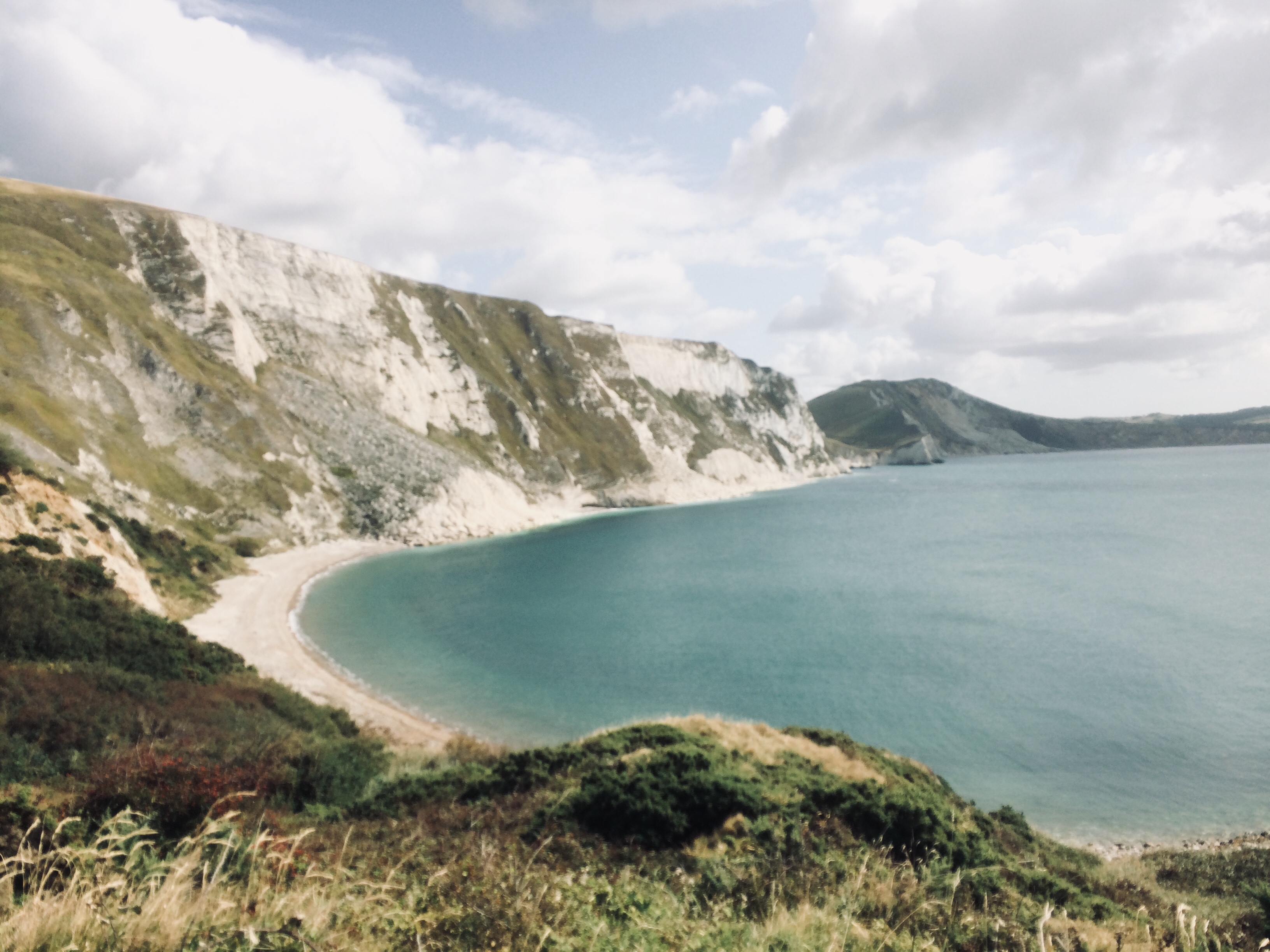
Our nomad’s life — a different bed each night — ended at Lulworth Cove, where two rocky arms reach out from the earth to hold a fragment of the ocean in a circular embrace. There being no accommodation available along our track past this point, and having secured a B&B in Corfe Castle whose lovely owner was willing to ferry us to and from the path, we resolved to do the final 50 or so kilometres at a leisurely pace as four half-day walks.

A few miles along from the hyper-touristy Lulworth Cove Village, above the drowsily quiet Tyneham Bay, Walking Buddy (WB) settled into his now habitual mid-way siesta, and I was absently musing ‘How do I love thee, let me count the ways’ – addressing SWCP of course, NOT WB!

A bird of prey soared into view from the rocks to our left. Bird-watchers had told us to look out for kestrels around here. If we are lucky we might even see a peregrine falcon. Three flaps of the wing took the raptor up into the glare of the mid-afternoon sun and beyond my iPad camera’s reach. Then it stopped dead in the sky. Two helicopters flew past (not unexpected, here the path borders a military training area). The bird held its place undaunted. Then it swooped, rose again almost immediately, floated like a feather, fluttered so fast that its wings disappeared and for a split second it looked like a giant dragon fly. It rested on the wind for what seemed like an impossibly long time. Finally, at lightening speed it darted towards the earth, straight as an arrow and disappeared from sight past the last visible cliff.

In its dramatic war dance, the falcon seemed to sketch a microcosm of our path across the sky: a thin line between the infinite blue to our right and the strange shapes of the land to our left, it rises and falls, sometimes edgy and rapid; elsewhere it arcs gently and then plateaus and slides quietly down a paddock.

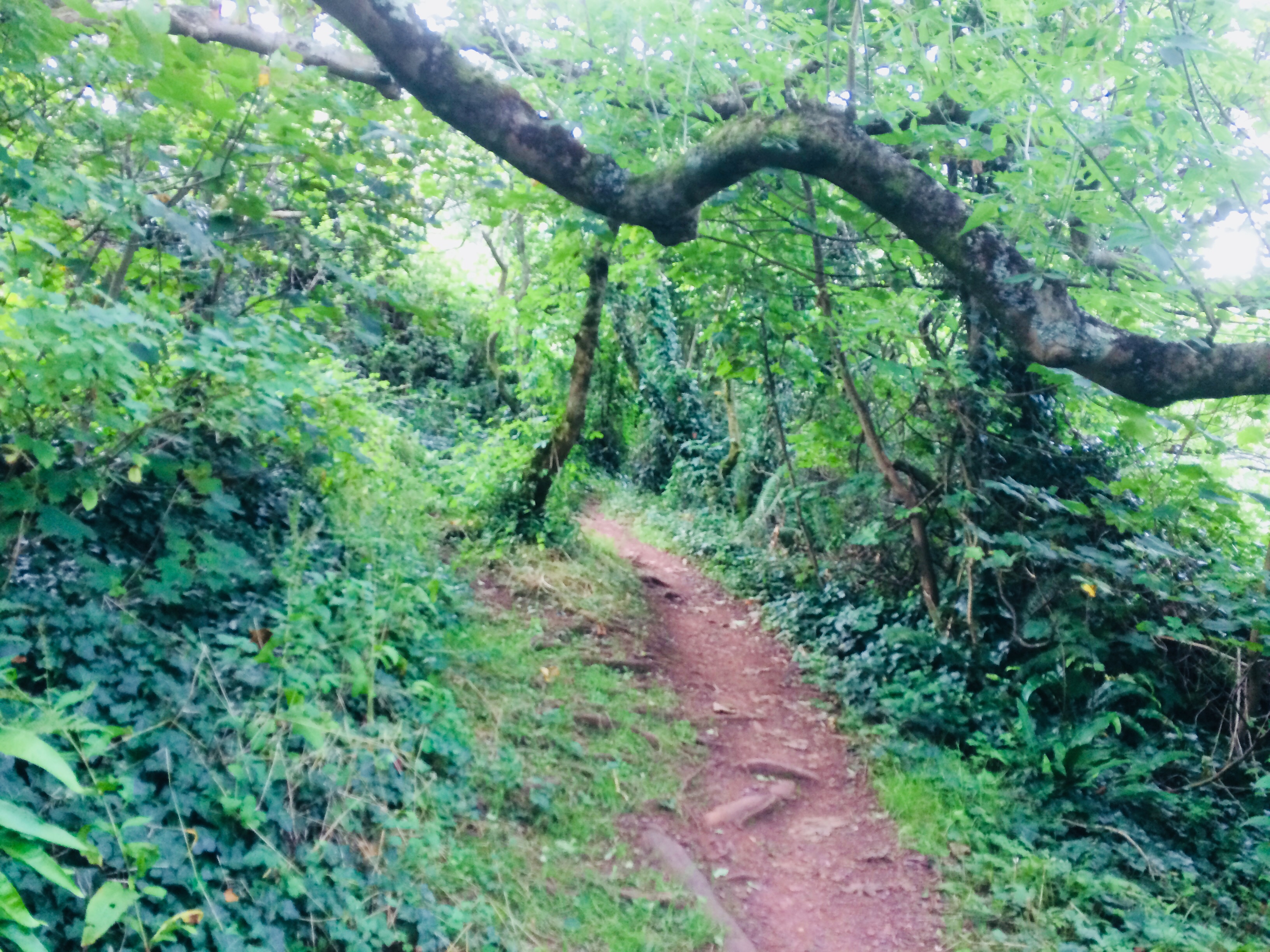
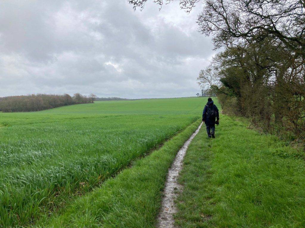
From Minehead, the trail drifts west, at first through the ancient woodlands of the Exmoor National Park, on and off the strangely flat-topped ‘hogback’ hills. It flattens on reaching Devon’s muddy river banks, then becomes increasingly rugged as it nears Cornwall. In North Cornwall the track scales some of the highest cliffs of the Atlantic coast and plunges down to the sandy beaches, again and again, determined to test the walker’s will. Here a hundred or 200 metre climb five or six times in a row is all in a day’s walk.

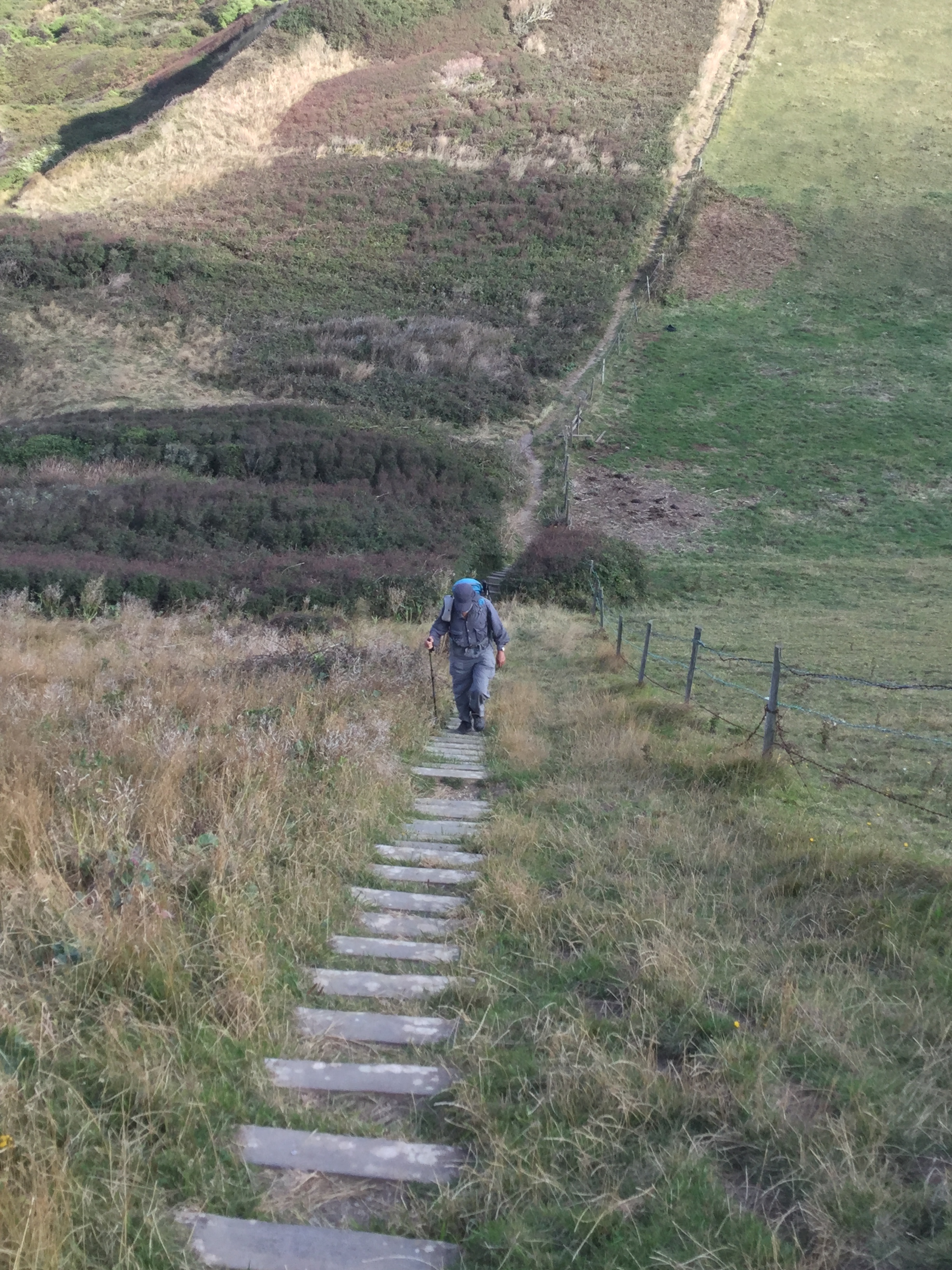
If you have never climbed a hundred meters, then imagine taking the stairs up a 35 storey building, then imagine those steps are 10 inches wide, slippery, broken and there are no hand-rails. Now climb down those same steps and up 45 storeys… there are no lifts and your bedroom for the night is still three sky-scrapers away.

Land’s End is as far west as you can go, so tourists are here in droves. At dusk the inflatable theme-park wallahs roll up their plastic and most visitors leave with their kids and dogs. The sun sinks into the clouds somewhere between the Cornish west and the Canadian east. There is no landmass in between.

From here the path turns south to The Lizard (nothing to do with reptiles, something Cornish to do with heights), the most southerly headland of UK. The nearest car park is nearly a kilometre away, and the only way to get to the cove is on foot. From here the path turns right back, heading east again. The water to our right for the rest of the way is the English Channel.

As the track turns first south and then east, there is a subtle change in the terrain: the south coast is just a little less craggy. The razor-sharp angular slate shapes of the north coast begin to give way to gigantic stone eggs, cakes and mushrooms! The hills get greener and rounder still as the path reaches South Devon. Finally, in Dorset, the dramatic rocks of the Jurassic coast, red, gold and white, rise in straight walls from pebbly beaches below. This land is fragile as it is beautiful.

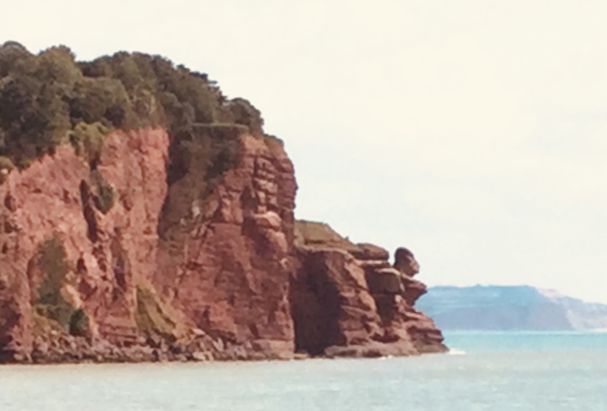
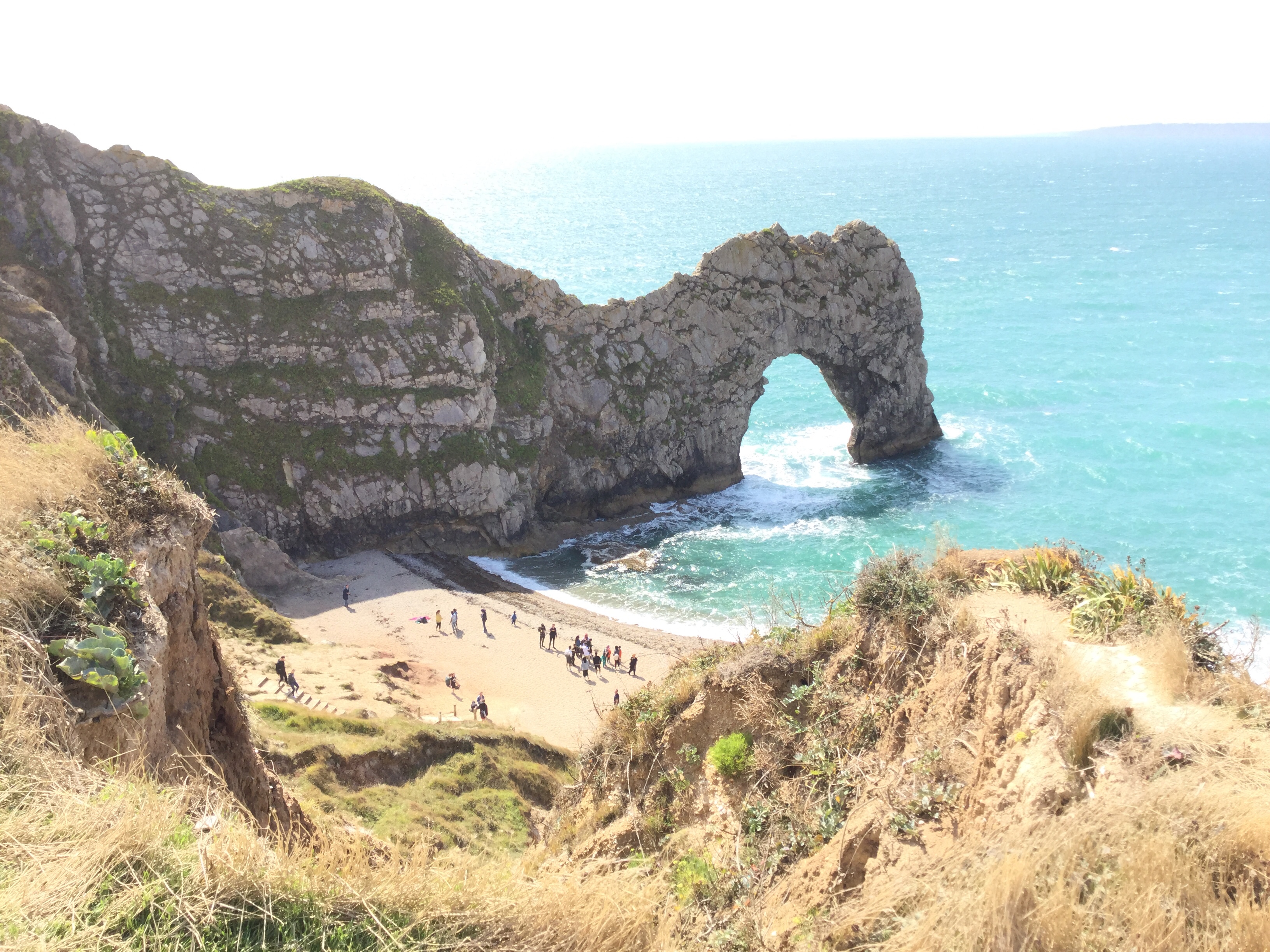
A hilarious Bengali satire (Ulat Puran, Re-Versed) imagines what might have been had Indians colonised Britain. I’m pretty sure that under Indian rule, the South West Coast Path would have been filled with Hindu pilgrims. I can see temples and deities rising from the deep. On the soft red sandstone above a beach in South Devon, someone must have carved the profile of a giant Jagannath, the arm-less Lord of the Universe. The Durdle Door (already a tourist Mecca) is undoubtedly the head of the elephant god making waves by sucking up and blowing out the sea in his trunk.

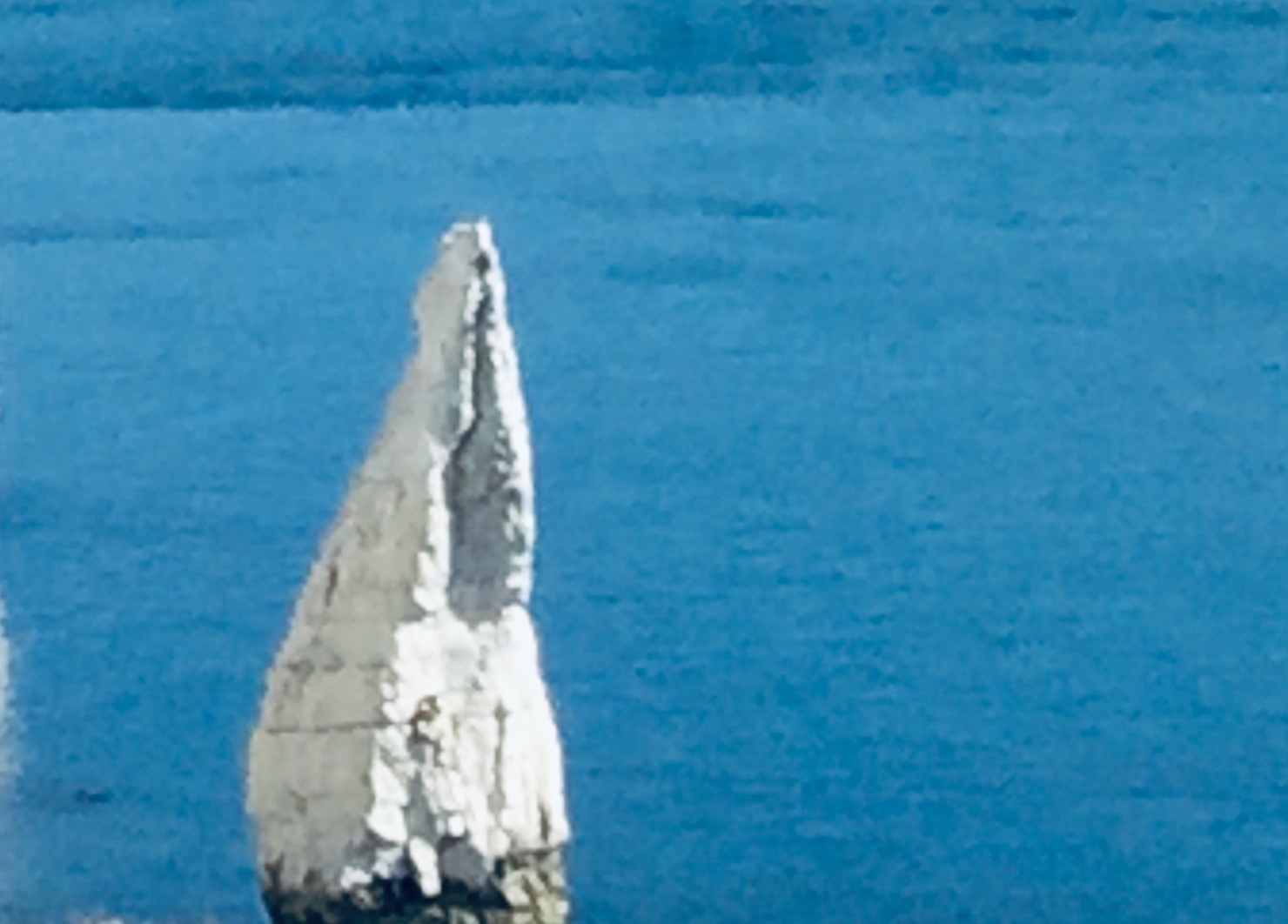
About five kilometres before the little blue marker where the SWCP formally ends, a less arcane signifier: white sandstone palms rise toward the sky in gratitude or perhaps a salutation.

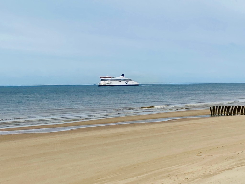
Soon the path disappears into a long white sandy beach, like the one near my house on a far-away coast in another hemisphere. I kick off my boots, shrug off the hike and splash through the lapping water for the home stretch.

Starting and ending unceremoniously, as it does, the South West Coast Path underscores perhaps, that a road is more than any or even the sum of all the places it takes you to; that destinations might be less important than the means and methods we use to get there; that in life as on a hike, the journey is all that matters, the end is neither here nor there.